
 |
 |
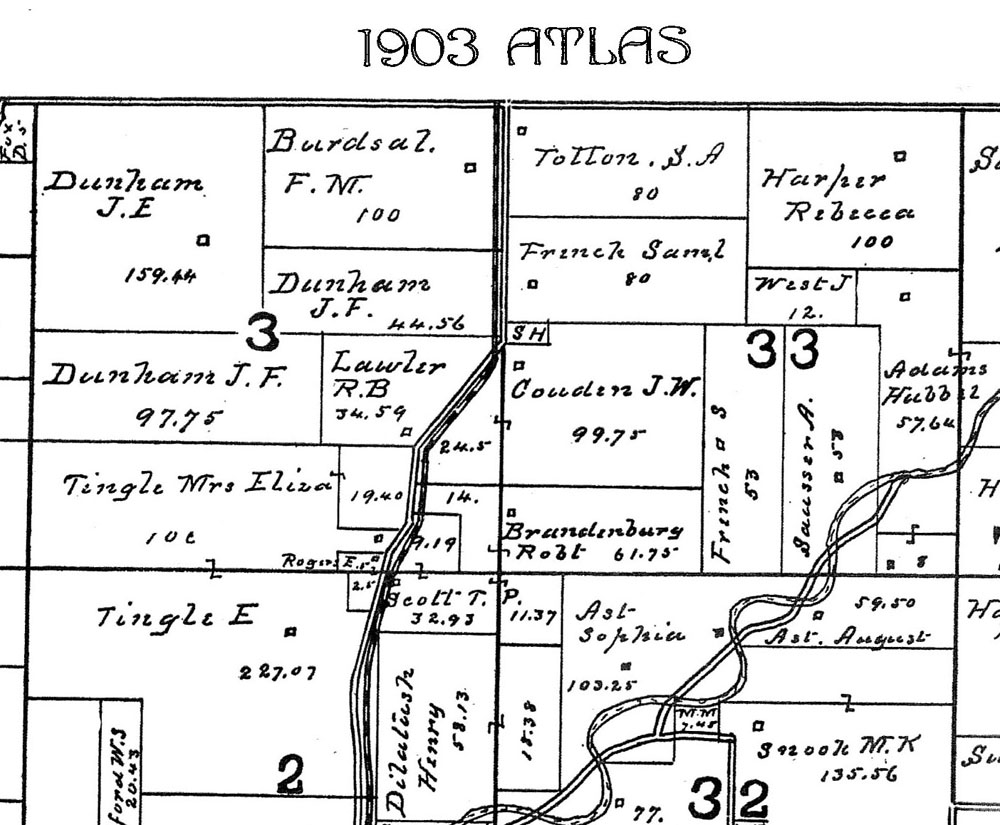 |
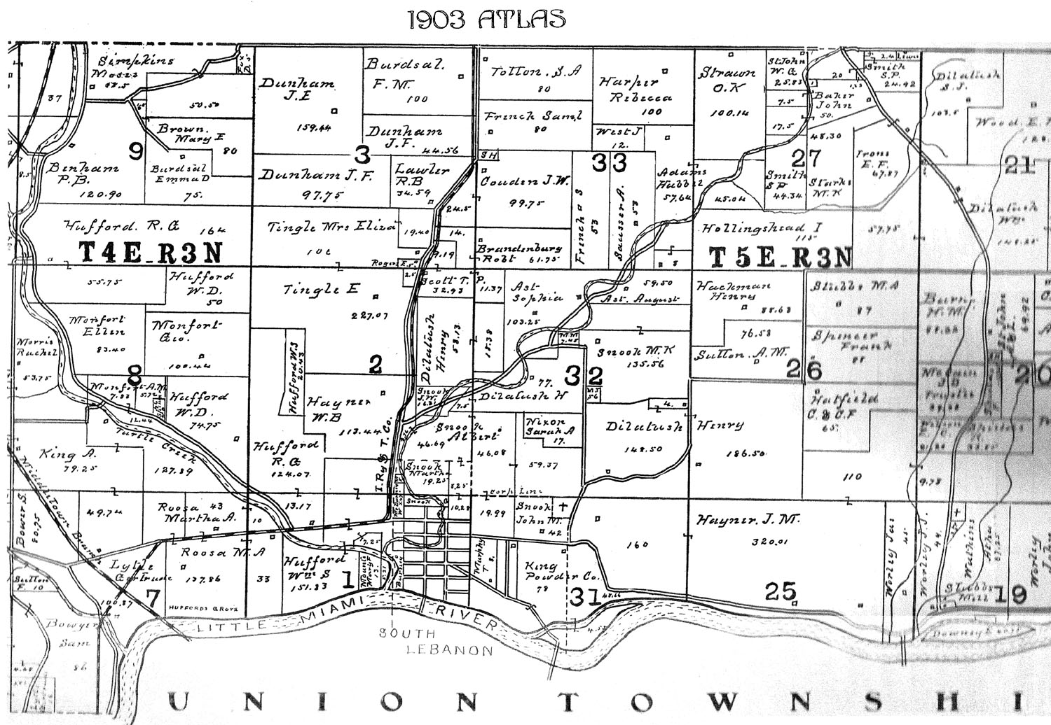
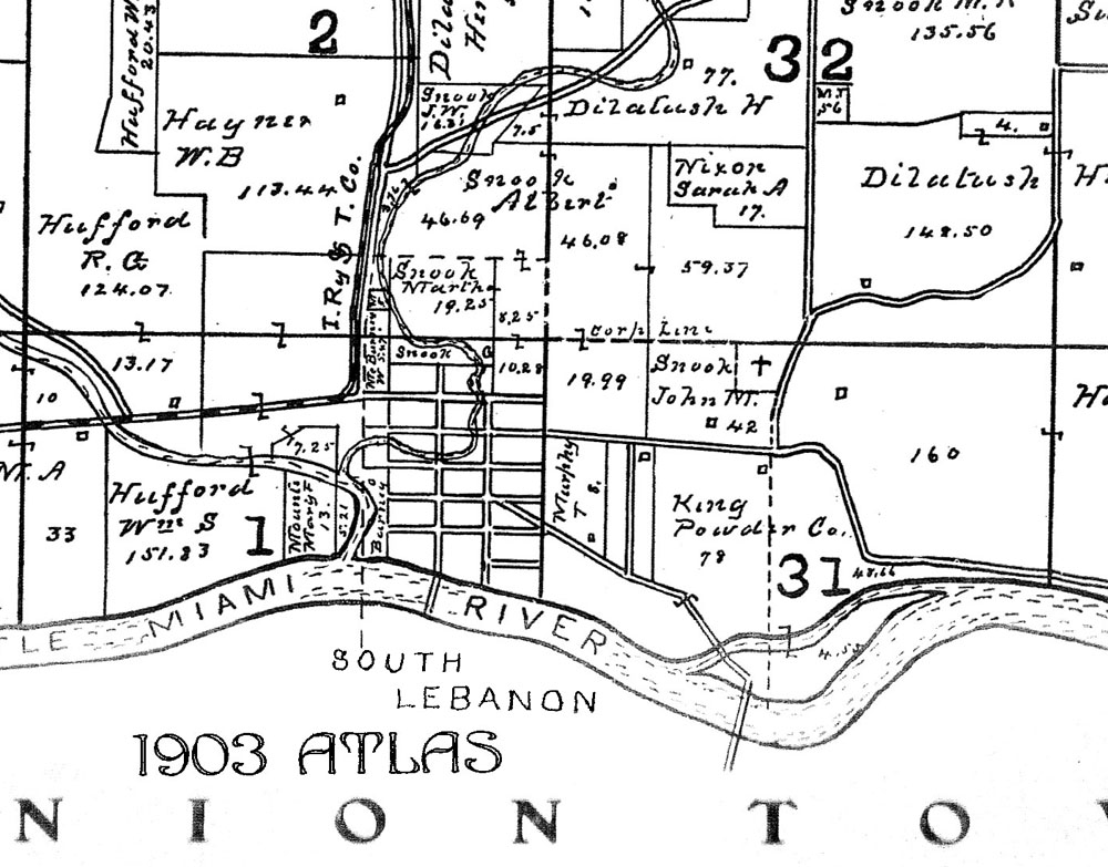
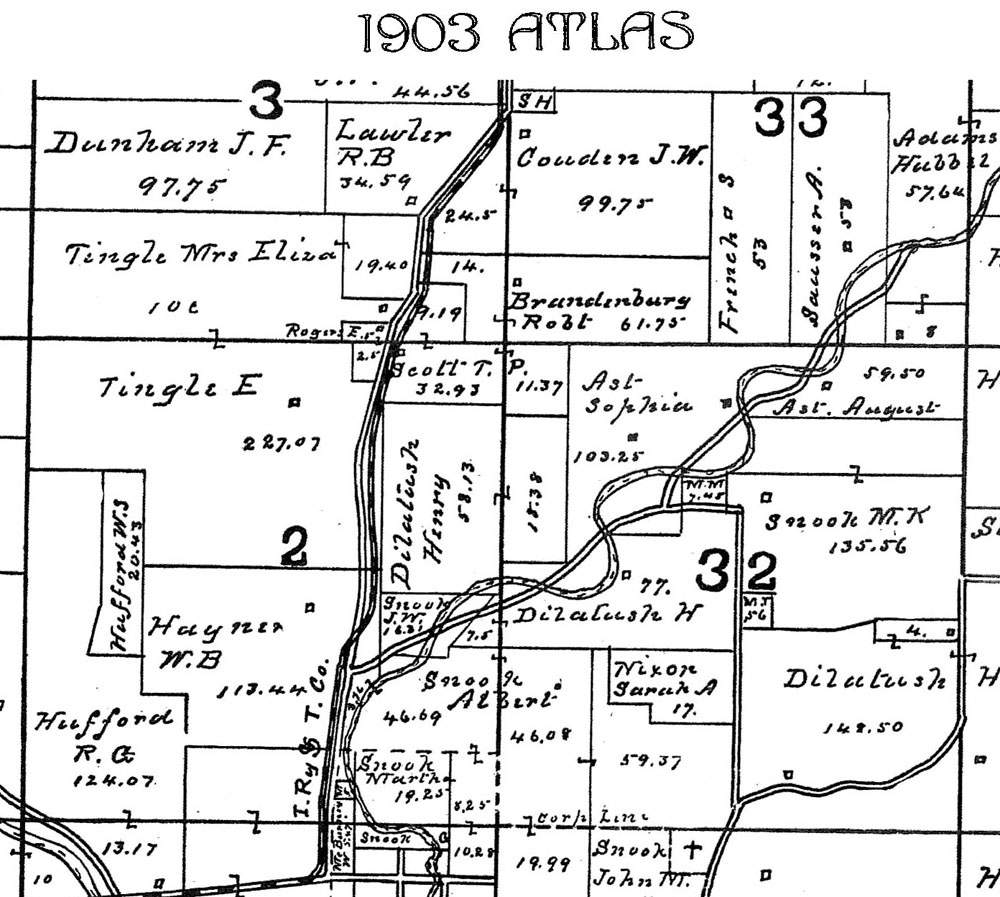
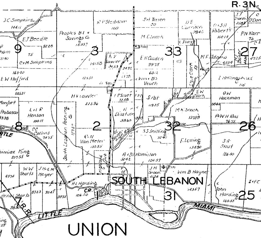
| close-up of sections 1 & 31 | close-up of sections 2 & 32 | close-up of sections 3 & 33 |
This
page is part of the Warren County Ohio GenWeb Project
You are our
visitor since 27 Oct 2004 -- thanks for stopping by!
Contact Katherine
Lollar Rowland if you would like to contibute to "The Ridge"
pages on the Warren County OHGenWeb project
Return to "The Ridge" Home Page
| Related
Links: |
|
FOOTNOTES: [Contact Katherine Lollar Rowland if you would like to contibute to "The Ridge" pages on the Warren County OHGenWeb project ]
Return to "The Ridge" Home Page
NOTICE: All documents and electronic images placed on the Warren County OHGenWeb site remain the property of the contributors, who retain publication rights in accordance with US Copyright Laws and Regulations. These documents may be used by anyone for their personal research. Persons or organizations desiring to use this material, must obtain the written consent of the contributor, or their legal representative, and contact the listed Warren County OHGenWeb coordinator with proof of this consent.
This
page created 27 October 2004 and last updated
27 October, 2004
© 2004
Katherine Lollar Rowland & Arne
H Trelvik All rights reserved