Edwardsville Cemetery, Harlan Twp, Warren County, Ohio
This page is part of the Warren County Ohio GenWeb project
You are our [an error occurred while processing this directive] visitor since 5 April 2006 -- thanks for stopping by!

Warren County, Ohio, Virtual Cemetery Project
a project of the Warren County Genealogical Society a chapter of the Ohio Genealogical Society
in partnership with the Warren County OHGenWeb Project.


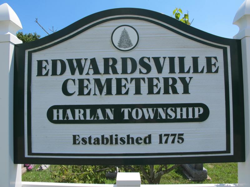
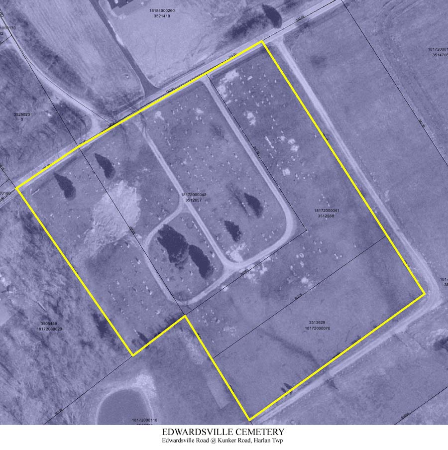
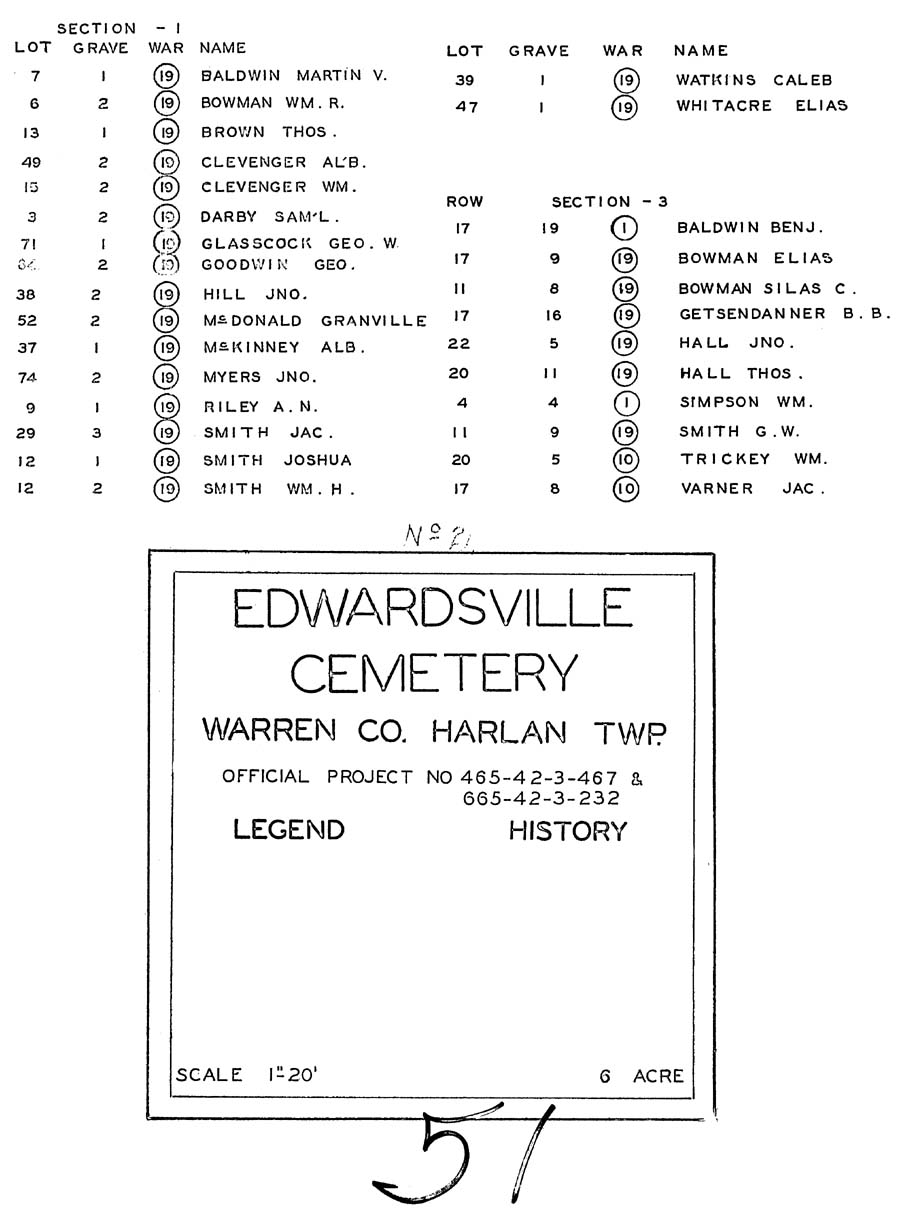
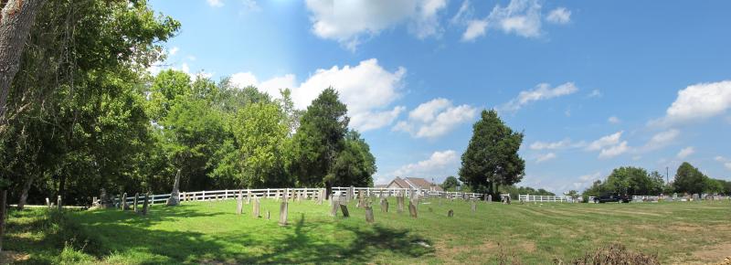
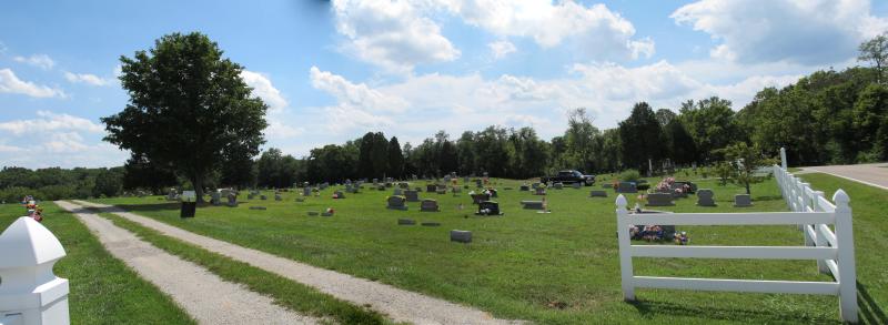
Edwardsville Cemetery
Edwardsville Road at Kunker Road
Harlan Township, Warren County, Ohio

Index to Available Tombstone Photos
A B C D E F G H I J K L M N O P Q R S T U V W XYZ [no surname] [Edwardsville Cemetery Home page]
If we have a photo, the name will be a "clickable" link.
[To add your photos email them in jpg format to  Arne H Trelvik ]


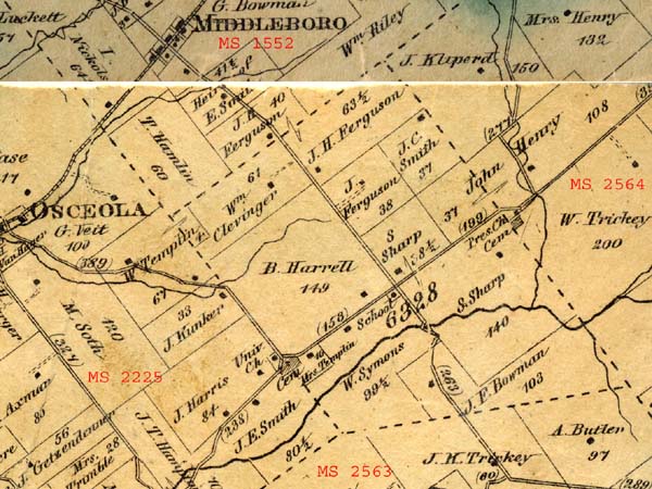
This is an active cemetery [ODRE #9821598-T] owned and operated by the Harlan Township Trustees. I do not known when the cemetery was first established but evidence of its existance can be seen on both the 1856 and 1867 Wall Maps of Warren County. The 1867 Map shows a Universalist Church located across the road from the cemetery to the west and perhaps it was originally a church cemetery. Beers History of Warren County does not appear to make any mention of the cemetery but in a passage regarding religious societies in Harlan Twp on page 679 it says
"Other denominations have been organized, and held services in the township, among them the Presbyterian and Universalist churches, but they never succeeded in establishing a permanent society."

Location:  
  • southeast side of Edwardsville Road (County Road 196) at the intersection of Kunker Road (Township Road 202)
  • "Ohio Cemeteries 1803-2003" by the Ohio Genealogical Society lists as cemetery #12254
  • Coordinates: 39°20' 0.16"N, 84° 2'3.26"W
  • Military Survey #6328
Links:  
Transcriptions:  
Variant Names:  
  • Smith Graveyard [per Warren County Property Records, the old section of the cemetery was known as the Smith Cemetery/Graveyard]

Photographic Records. [Click on the thumbnail images for larger photos]
(photos are reduced to a 600 pixel width and thumbnails to a 100 pixel width. Larger images "may" be available)
I would be happy to include any photos that you may wish to contribute to this page
Portions of Warner's 1867 Wall Map of Warren County centered on Military Survey #6328. Edwardsville cemetery is at the end of what is now Kunker Road coming down from Osceola on the south side of what is now Edwardsville Road (CR 196). The village of Edwardsville is not identified as such on the map but it would be at the next intersection northeast with Middleboro Road (CR 45) where a school is shown. Note that if you continue northeast on Edwardsville Road, a Presbyterian Church and Cemetery is shown just before you get to what is now Fisher Road heading north.  by
Arne H Trelvik
5 April 2006
Aerial Photo extracted from Warren County Auditor web site with outline of property currently owned by the Harlan Twp Trustees  by
Arne H Trelvik
5 April 2006
Edwardsville Cemetery #21 - Plat from the Veteran Graves Registration Project by the WPA during the depression  by
Arne H Trelvik
10 August 2008
List of Veterans from Edwardsville Cemetery #21 - Plat from the Veteran Graves Registration Project by the WPA during the depression  by
Arne H Trelvik
10 August 2008

Samuel Gammell

Darren Waters writes,
"I saw the handmade stone and had to investigate...I now have a full family tree file for anyone interested...... "

 by
Darren Waters
5 April 2006


North Section

Old Section - looking northeast (Smith Graveyard)

Old Section - looking southeast (Smith Graveyard)

Index to Available Tombstone Photos
A B C D E F G H I J K L M N O P Q R S T U V W XYZ [no surname] [Edwardsville Cemetery Home page]
If we have a photo, the name will be a "clickable" link.
[To add your photos email them in jpg format to  Arne H Trelvik ]

NOTICE: All documents and electronic images placed on the Warren County OHGenWeb site remain the property of the contributors, who retain publication rights in accordance with US Copyright Laws and Regulations. These documents may be used by anyone for their personal research. Persons or organizations desiring to use this material, must obtain the written consent of the contributor, or their legal representative, and contact the listed Warren County OHGenWeb coordinator with proof of this consent.

This page created 5 April 2006 and last updated 10 August, 2014
© 2006-2012 Arne H Trelvik  All rights reserved